
For time immemorial, Anishinaabe have utilized, occupied, and protected these lands for current and future generations. The Robinson Huron Waawiindamaagewin (RHW) Use and Occupancy Study is an initiative undertake by the 21 First Nations of the Robinson Huron Treaty to address issues that have, until this time, been addressed within Canadian government-created agencies and systems of governance.
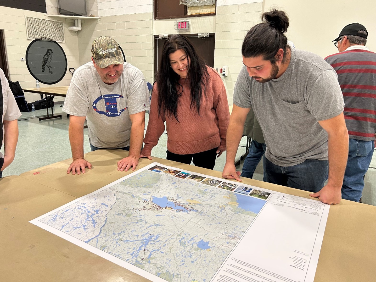
Nipissing First Nation was the first community to conduct a series of map-based interviews with Nbisiing Anishinaabe to tell the story of a person’s life on the land in picture form. The research team consisted of Curtis Avery, Manager of Environment at Nipissing First Nation, and Terry Tobias, Land Use and Occupancy Research Specialist. Interviews began in October 2022 and wrapped up in January 2023. Each participant received an honouarium and were invited to a community feast to celebrate their contributions and receive a personalized map biography of their own harvesting experience.
On Tuesday, January 31, 2023, Nipissing First Nation hosted the RHW Land Use and Occupancy Verification and Map Hand-Back Celebration in Garden Village. Participants, community members, and the research team, gathered to celebrate the success of the study and the community’s living legacy of use and occupancy within our traditional territory.
“I had the pleasure of listening and learning from all the participants,” says Curtis Avery, lead of the project. “It was eye-opening and a great crash course into our Nation’s history, values, and dynamics between us Anishinaabe, society, nature, and land.”
Respondents shared family stories of persecution and oppression by the past Ministries on members exercising their inherent rights; the burning of incidental cabins, homesteads, and structures along the shorelines, bays, and islands of Lake Nipissing; and stories of hunting excursions made by those brave members who dare contest the rules of the Indian agent, past government laws and regulations, and the Indian Act itself. All these learnings are portrayed in the maps that were developed.
“Because of our people’s defying acts and resiliency, we gather today, to bear witness to these maps, and observe our far-stretching relation to these lands, the flora, fauna, and resources they contain,” says Avery. “These lands represent an extension of us, our culture, and they will continue to inform our evolution as a community and people as it has since time immemorial.”
The goal of the RHW Land Use and Occupancy Study was to collect data crucial to assert jurisdiction and protect areas of Anishinaabe importance. The maps may look like regular maps, but they tell the stories of our members' lives on the land. These stories can identify where Anishinaabe land users have a direct extensive link to harvesting such as hunting, fishing, trapping, medicines, and producing maple syrup. None of the personal information provided by respondents during these interviews are shared publicly.
The research is valuable to protect Anishinaabe Rights and interests, monitor the ecosystem, clarify use and occupancy, understand overlapping jurisdiction, provide valuable evidence for litigation, and create resources.
The maps will be in our governing toolbox going forward in conjunction with strong leadership, that will help guide Nipissing First Nation throughout future endeavors, enabling us to leverage opportunities for Nipissing Nation, the people, the land, and the future.
Chi-Miigwech to all the participants who shared their direct extensive experience in our world-renowned research.
